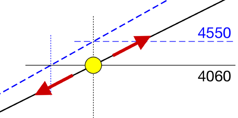
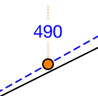
Temperature and elevation values are mandatory. After input the main graph can be used in simple mode. Moving the yellow dot will show an altitude in black and its corrected value in blue.
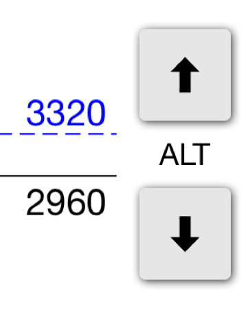
For fine tuning you can change the altitude in 10’ steps by pressing the up or down button at the right.
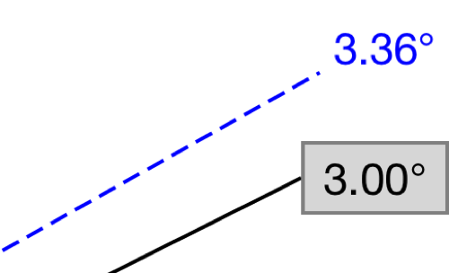
GPA/VPA is preset to 3.00°. The published black glidepath will be smaller at low temperatures. The blue glidepath is temperature corrected. It is needed for an approach using a GPA mode.
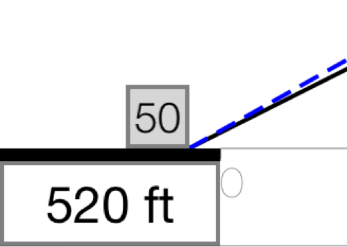
TCH is preset to 50’. Adjusting the TCH is only improving the accuracy of the distance to threshold value. TCH value will become mandatory for a GPS approach showing distance to threshold.
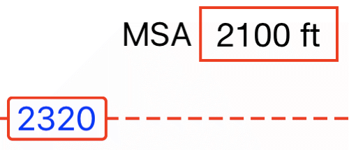
The corrected MSA value will be shown in blue together with a dashed red altitude line for visual impression.
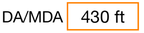
The corrected DA/MDA will be shown as an orange dot on the corrected GPA. The corrected value will be displayed in blue.
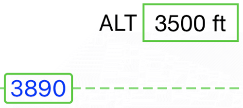
After entering an optional altitude the corrected value is displayed similar to the MSA as a green line. In addition a green dot is displayed on the vertical profile showing the distance to threshold or DME value on the glide path.
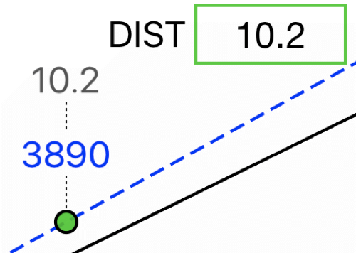
While entering an altitude and no DME station was defined, you may switch from altitude to distance to threshold. The green line will not be displayed. Distance and corrected altitude will be shown above the green dot.
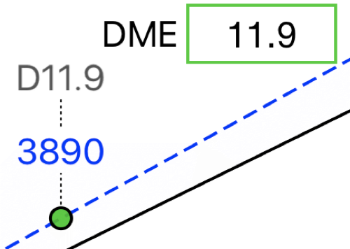
While entering an altitude and a DME station was defined, you may switch from altitude to DME. The green line will not be displayed. DME value and corrected altitude will be shown above the green dot.
Minimum range is 3 nm, maximum range is 20 nm.
It equals the distance to threshold scale.
Range change can be done by:
- a pinch (zoom) gesture
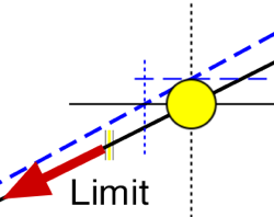
- moving your finger further behind yellow dot limit
Yellow dot limit is marked by a small vertical yellow line.
The lock disables all touchable elements to avoid unwanted touches.

After entering an additional ALT, the graph is zoomed to show the final descent from this ALT.
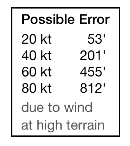
After entering a high MSA depending on the runway elevation a table showing a possible altimeter error will be displayed: