Cold Weather Altitude Correction is a tool for calculating temperature corrected altitudes.
Conventional tools are only calculating a list of altitudes. This tool is designed more closely to a real approach. It is showing the corrected altitudes in a graphical interface:
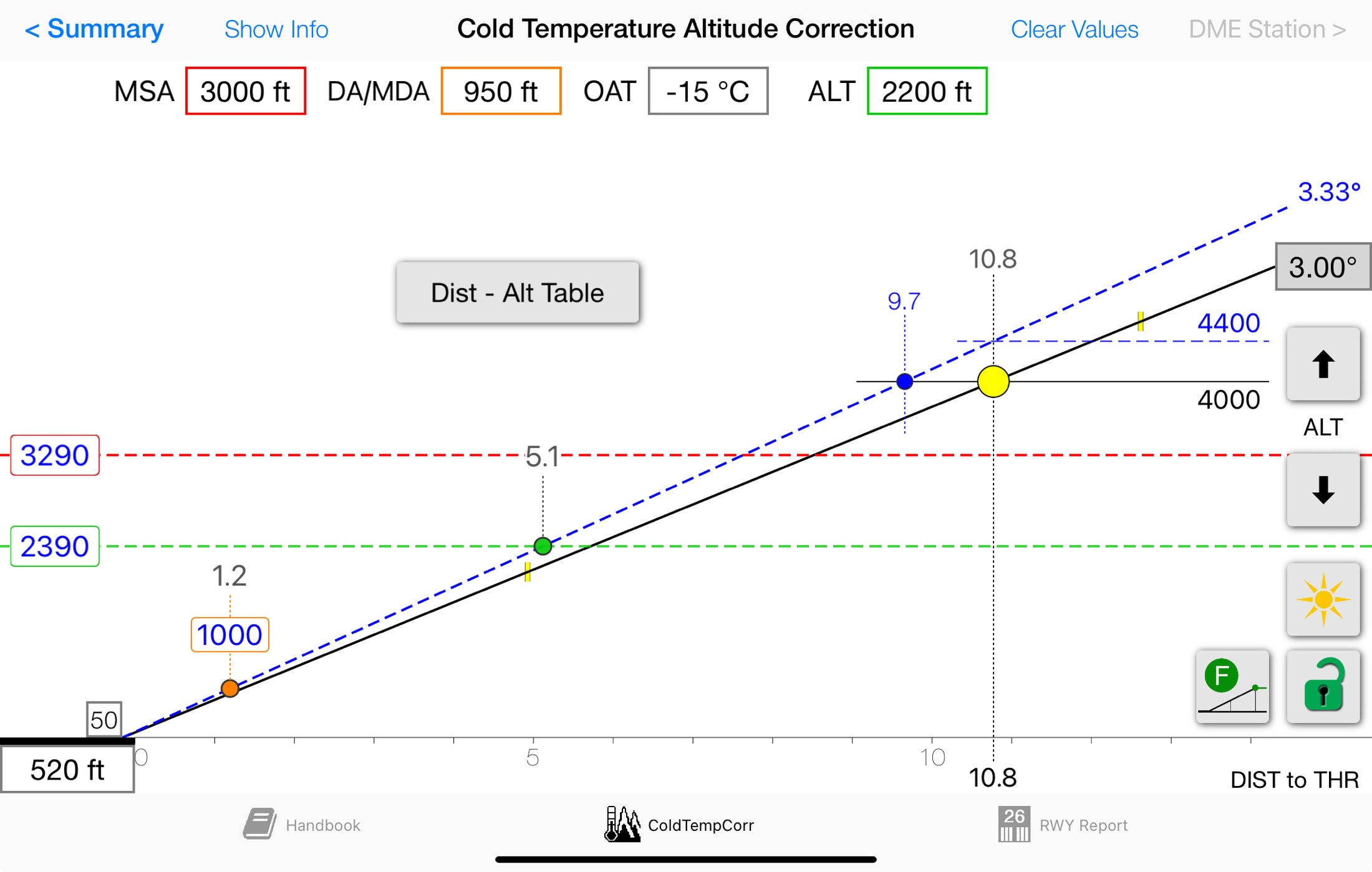
Corrected values are always blue. With only temperature and elevation you can move the yellow dot along a vertical profile to show the corrected value for any desired altitude .
In addition you may enter values for MSA, DA/MDA and GPA to calculate their corrected values and have a visual impression of the approach.
An additional altitude, distance to threshold or DME value may be displayed as green line and/or a green dot on the profile.
But the real sophisticated part is the Distance - Altitude Table:
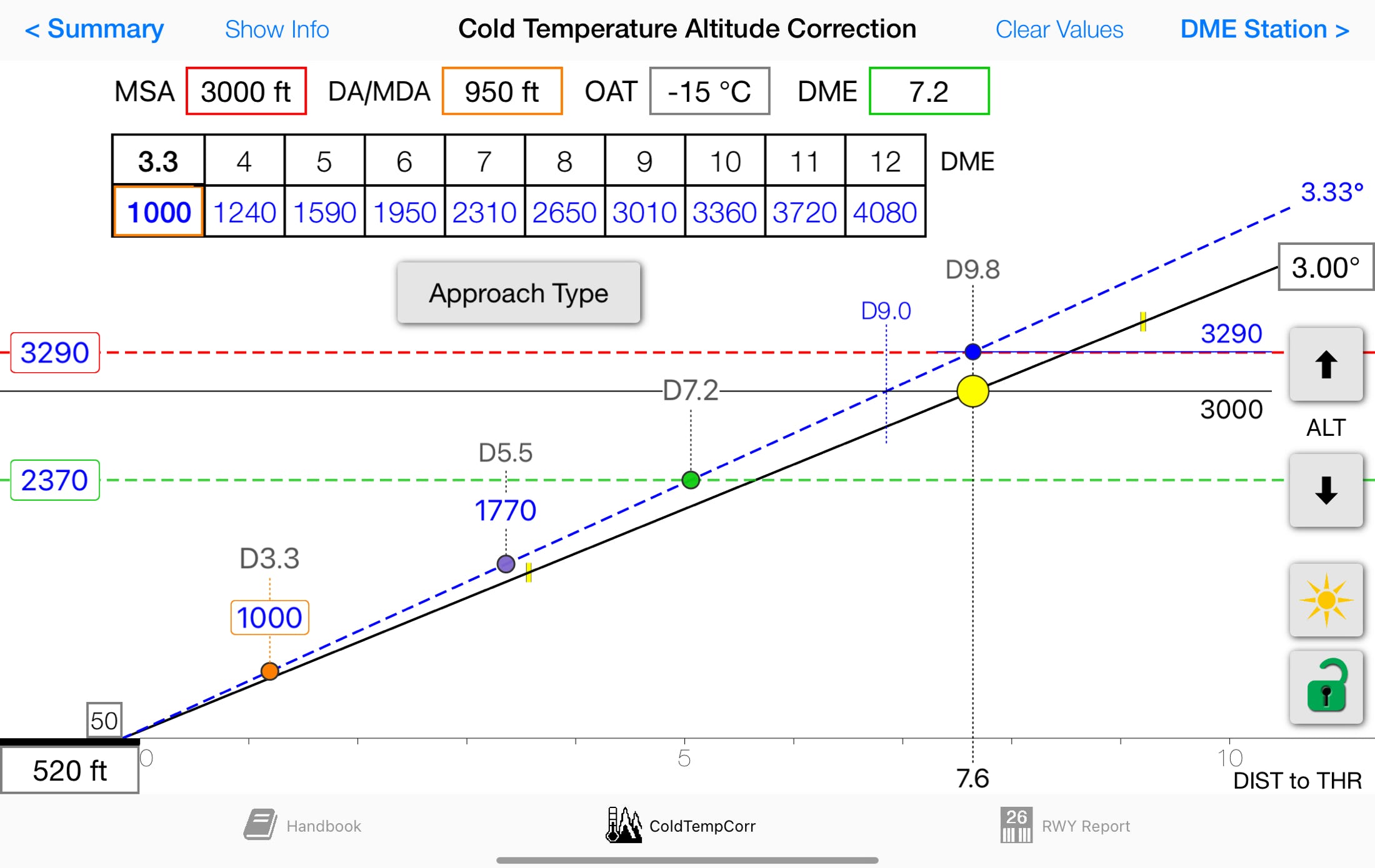
A table with distances and corrected altitudes will be calculated.
The distances may be distances to threshold or distances to a user defined DME station. The DME station must be on or close to the centerline.